Continents are a convention, so the answer depends on where you put the lines between them. I sort the countries into three groups: the ones a continental border cuts in two under every common version, the ones that count only under some versions, and the ones that reach another continent across the sea.
Which countries are on two continents?
Four, for certain: Russia, Turkey, Kazakhstan and Egypt. In each one, the border between two continents runs across the country's own land or through a strait inside it.
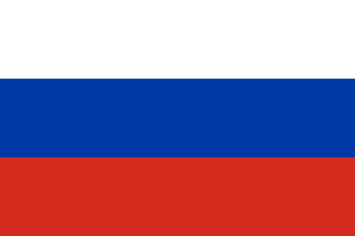 Russia
- Continents:
- Europe and Asia
- Where the line runs:
- The Ural Mountains
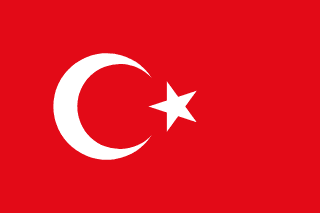 Turkey
- Continents:
- Europe and Asia
- Where the line runs:
- The Bosporus, the Sea of Marmara and the Dardanelles
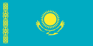 Kazakhstan
- Continents:
- Europe and Asia
- Where the line runs:
- The Emba River and the Mughalzhar Hills in the far west
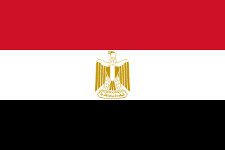 Egypt
- Continents:
- Africa and Asia
- Where the line runs:
- The Suez Canal
| Country | Continents | Where the line runs |
|---|---|---|
| Russia | Europe and Asia | The Ural Mountains |
| Turkey | Europe and Asia | The Bosporus, the Sea of Marmara and the Dardanelles |
| Kazakhstan | Europe and Asia | The Emba River and the Mughalzhar Hills in the far west |
| Egypt | Africa and Asia | The Suez Canal |
Russia is the giant of the group. Britannica describes it as covering the whole of northern Asia and the eastern third of Europe. The Ural Mountains, the traditional boundary between the two, run through the west of the country. Moscow and St Petersburg are both on the European side.
Turkey is the other way round. Nearly all of it is Anatolia, in Asia; only Turkish Thrace, a small corner in the northwest, is in Europe. The Bosporus runs through Istanbul, so Turkey's largest city has a European side and an Asian side.
Kazakhstan's European part is a strip in the far west. Britannica's border follows the Emba River and the Mughalzhar Hills there, which leaves a small part of the country in Europe.
Egypt's Asian part is the Sinai Peninsula, east of the Suez Canal. Britannica gives the Sinai an area of 61,000 km², about 6 percent of Egypt, and says it is usually regarded as part of Asia.
Countries that count only under some borders
Georgia, Azerbaijan and Armenia are in the Caucasus, where geographers draw the border between Europe and Asia in several different places. Britannica describes four versions. Two of them put Georgia and Azerbaijan on two continents, and only one does the same for Armenia:
- Leave the whole Caucasus in Asia. Britannica says most geographers now use this one, and it puts all three countries in Asia.
- Follow the crest of the Greater Caucasus: the north side in Europe, the south side (Transcaucasia) in Asia. Nearly all of Georgia, Armenia and Azerbaijan is south of the crest, but a few districts of northern Georgia (about 5 percent of the country) and of northern Azerbaijan lie north of it. So Georgia and Azerbaijan are split, and Armenia stays in Asia.
- Split the region west and east. The bulk of Azerbaijan and small parts of Armenia and Georgia go to Asia, the rest to Europe, and all three end up on two continents.
- Run the line along the Aras River and the Turkish border. That puts all three countries in Europe.
Panama is the other borderline case. Many definitions of North America, such as the US National Library of Medicine's, start at Panama's border with Colombia, which leaves all of Panama in North America. Some geographers use the Panama Canal as the boundary instead, and under that line Panama is on two continents.
Countries that reach other continents by sea
A longer group has its main territory on one continent and islands or territories on others. For most of the table, my rule is the UN's: a territory counts when the UN Statistics Division places it in a different region from its home country. Spain, Chile and Indonesia are there for land that is part of the country itself, and so is Hawaii, a US state that forms one corner of the Polynesian Triangle (the UN counts Polynesia as part of Oceania).
 France
- Also reaches:
- North and South America, Africa, Oceania
- Through:
- Guadeloupe and Martinique, French Guiana, Réunion and Mayotte, New Caledonia and French Polynesia
 United Kingdom
- Also reaches:
- North and South America, Africa, Oceania
- Through:
- Bermuda and the Caribbean territories, the Falkland Islands, Saint Helena, Pitcairn
 United States
- Also reaches:
- Oceania
- Through:
- Hawaii, Guam, the Northern Mariana Islands and American Samoa
 Netherlands
- Also reaches:
- North America
- Through:
- Bonaire, Sint Eustatius and Saba in the Caribbean; Aruba, Curaçao and Sint Maarten are countries within the Kingdom of the Netherlands
 Denmark
- Also reaches:
- North America
- Through:
- Greenland, a self-governing part of the Kingdom of Denmark
 Spain
- Also reaches:
- Africa
- Through:
- Ceuta and Melilla, on the North African coast
 Chile
- Also reaches:
- Oceania
- Through:
- Easter Island (Rapa Nui), in Polynesia
 Indonesia
- Also reaches:
- Oceania
- Through:
- The western half of New Guinea
| Country | Also reaches | Through |
|---|---|---|
| France | North and South America, Africa, Oceania | Guadeloupe and Martinique, French Guiana, Réunion and Mayotte, New Caledonia and French Polynesia |
| United Kingdom | North and South America, Africa, Oceania | Bermuda and the Caribbean territories, the Falkland Islands, Saint Helena, Pitcairn |
| United States | Oceania | Hawaii, Guam, the Northern Mariana Islands and American Samoa |
| Netherlands | North America | Bonaire, Sint Eustatius and Saba in the Caribbean; Aruba, Curaçao and Sint Maarten are countries within the Kingdom of the Netherlands |
| Denmark | North America | Greenland, a self-governing part of the Kingdom of Denmark |
| Spain | Africa | Ceuta and Melilla, on the North African coast |
| Chile | Oceania | Easter Island (Rapa Nui), in Polynesia |
| Indonesia | Oceania | The western half of New Guinea |
I count the Caribbean islands as North America, as the National Library of Medicine's definition does, and Britannica allocates Greenland to North America too. New Guinea is the less obvious one: its eastern half is Papua New Guinea, which the UN places in Oceania, and its western half is Indonesian. Ceuta and Melilla give the European Union its only land borders in Africa.
Some longer lists go further. They add Australia (for Christmas Island and the Cocos Islands, which the UN counts in Oceania anyway), Portugal (for Madeira, which lies off Africa, but Britannica counts it as European, as it does Spain's Canary Islands), Yemen (for Socotra, off the Horn of Africa), and Greece and Italy (for islands close to Turkey and Tunisia). Those rest on geology or distance rather than on any official grouping, so they are not in my table.
How many countries are on two continents?
It depends on the rule, which is why sources give such different numbers:
- 4 if only a country's own mainland counts and the border is the one most geographers use (Russia, Turkey, Kazakhstan, Egypt).
- 6 if the Caucasus line follows the crest of the mountains, which adds Georgia and Azerbaijan.
- 8 if you split the Caucasus west and east instead, which adds Armenia too, and draw the Americas line along the Panama Canal.
- 16 if you add the countries that reach another continent by sea, as in the table above.
For a quiz, the four clear cases are the safe answer. For the wider picture of how Europe ends in the east, see European countries by region.
Can you find them on a map?
The World Map Quiz names a country and you find it on a blank world map. Three wrong guesses and the run is over.
Play World Map QuizQuestions people ask
Which countries are in both Europe and Asia?
Russia, Turkey and Kazakhstan under every common border. Georgia and Azerbaijan are added when the line follows the crest of the Caucasus, and Armenia too when it splits the region west and east. Cyprus is in the EU, but the UN counts the whole island in Asia.
Which country is in both Africa and Asia?
Egypt. The Sinai Peninsula, east of the Suez Canal, is in Asia and the rest of the country is in Africa. Spain also has land in Africa, the cities of Ceuta and Melilla, but they are cut off from the rest of Spain by the sea.
Is Turkey in Europe or Asia?
Both. Nearly all of Turkey is in Asia, on the Anatolian peninsula. Turkish Thrace in the northwest, including the European side of Istanbul, is in Europe.
Is Russia in Europe or Asia?
Both. Russia covers the whole of northern Asia and the eastern third of Europe, with the Ural Mountains between them. Moscow is on the European side, and the UN counts the whole country in Eastern Europe.
Sources
- Britannica: Europe (the boundary with Asia, and the four Caucasus schemes)
- Britannica: Russia
- Britannica: Turkey
- Britannica: Bosporus
- Britannica: Ural Mountains
- Wikipedia: Transcontinental country (the Caucasus districts north of the watershed, and the Panama Canal line)
- Britannica: Sinai Peninsula
- World Bank: surface area (sq. km), 2024 (Egypt)
- Britannica: Georgia
- Britannica: Armenia
- Britannica: Azerbaijan
- US National Library of Medicine (MeSH): North America
- UN Statistics Division: standard country and area codes (M49), full list
- European Commission: the EU outermost regions
- The Irish Times: Ceuta, why Spain has the EU's only border in Africa (2026)
- Britannica: Easter Island
- Britannica: Hawaii
- National Library of Australia: Polynesian expansion, the Polynesian Triangle
- Government of the Netherlands: the parts of the Kingdom of the Netherlands
- Prime Minister's Office of Denmark: the unity of the Realm (Greenland)
- Britannica: New Guinea
- Britannica: Socotra
- European Union: EU countries (Cyprus)